Sikkim Silk Route Travel Guide: We had extensively explored Sikkim, but the Silk Route in East Sikkim had remained elusive. While we had visited the high-altitude lakes, offbeat hamlets, and monasteries of Sikkim, the famed hairpin bends of Zuluk were still uncharted for us. Ultimately, a spontaneous decision led us to board the Darjeeling Mail, reaching New Jalpaiguri and embarking on our Sikkim Silk Route adventure.
The Sikkim Silk Route tour can be commenced from either New Jalpaiguri (NJP) in West Bengal or Gangtok in Sikkim. We chose to start our journey from NJP and conclude it in Gangtok, making stops at Aritar, Zuluk, and Nathang Valley along the way. Continue reading for more details.
History of the Sikkim Silk Route
The Silk Route in East Sikkim available for tourist exploration is a segment of the ancient Silk Road. The Silk Road was an extensive network of trade routes connecting Asia to the Mediterranean, passing through China, India, Persia, Arabia, Egypt, Greece, and Italy. Established during China’s Han Dynasty in 130 BC, it facilitated commerce from 130 BCE to 1453 CE.
The Sikkim Silk Route we see today is just a fraction of this historic route. It was part of a larger trade network linking Lhasa in Tibet to Tamralipta in West Bengal, with Lhasa being a significant trade hub. Tamralipta, now Tamluk in West Bengal, was the nearest seaport to Lhasa.
Old Silk Route
This entire Silk Route spanned 900 km from Lhasa to Tamralipta, starting from Tibet’s Chumbi Valley, crossing Nathu La, traversing the hills of East Sikkim, and finally reaching Bengal’s plains. The Chumbi Valley connects Sikkim to the southwest through the Nathu La and Jelep La passes and is situated in the narrow land between India and Bhutan, known for the Doklam dispute between India and China.
The Silk Road was a major conduit for trade, including Chinese silk, textiles, tea, spices, dyes, medicines, glassware, fruits, and even camels. It also facilitated the exchange of knowledge, ideas, and culture. However, its significance has diminished due to geopolitical changes.
Silk Route Sikkim Travel Guide
In India, the Silk Route is accessible from Rongli to the Nathula Pass. The route is not only historically fascinating but also offers stunning views, attracting tourists to East Sikkim.
View of Kanchenjunga from the Sikkim Silk Route
While the Silk Route attracts many visitors from Bengal in October, particularly during Durga Puja, it remains relatively unexplored by tourists from other regions of India. There are no major towns along the Silk Route circuit, but homestays offering basic amenities are available throughout the area.
Zuluk on the Sikkim Silk Route
The Silk Route journey begins at Rongli, situated at 5000 feet near the Bengal-Sikkim border. While Silk Route packages might mention stays at Rishikhola, Icchey Gaon, or Sillery Gaon, these are in West Bengal and not part of the actual Silk Route. These picturesque villages are at the route’s foothills and can be visited to break your journey.
Our Itinerary
As mentioned, we began our Silk Route tour from NJP. Here’s a detailed itinerary of our Sikkim Silk Route adventure:
Day 1: NJP – Aritar (110 km)
We spent our first night in Aritar, a charming Sikkimese village at an altitude of 4000 feet, slightly off the traditional Silk Route. Our train to NJP was delayed, and we arrived around 10 AM. We had arranged a car for the trip, which was waiting for us at NJP. The drive to Aritar took about 4.5 hours after crossing the Rangpo Checkpost at the Sikkim border. By the time we reached Aritar, it was drizzling.
After checking into our homestay and having lunch, we explored the village on foot. Given the late hour, we decided to rest for the day and explore Aritar the following day.
Alternative Stop: Mankhim
Day 2: Aritar – Zuluk (42 km)
We departed early from Aritar, despite the gloomy weather. Aritar is known for Lampokhri Lake, an artificial lake surrounded by pine-clad hills, and a nearby monastery. Boating on the lake is an option, and there is also a trekking trail leading to the Mankhim Top viewpoint.
Mankhim
Located 3 km from Aritar, Mankhim is renowned for its viewpoint, which offers panoramic views of the Kanchenjunga ranges. Mankhim is a small Rai community village with a temple and monastery. The viewpoint provides an unobstructed view of the snow-capped mountains and the Lampokhari Lake below.
Que Khola Falls
Located 2 km from Mankhim, Que Khola Falls is a small roadside waterfall with tea stalls offering snacks and drinks.
Rongli
Rongli, an essential stop in East Sikkim, is surrounded by lush greenery and the Rangpo River. It’s where you need to obtain your Inner Line Permit (ILP) to travel beyond to Zuluk and Nathang Valley. Rongli is a peaceful town with several forest trails.
After acquiring our permits, we continued our journey on the Silk Route. The smooth roads and picturesque scenery reminded us of the historic trade caravans that once traversed these paths. The journey through Rongli marked the beginning of our ascent.
Lingtam
Lingtam, the next village, has a checkpost for permit verification. It’s a small village with a few homestays, where you can take a brief stop and capture some photographs.
Padamchen
Situated at 8000 feet, Padamchen is a scenic village surrounded by greenery. It’s an excellent place for an overnight stay with several homestays offering basic amenities. Padamchen features walking trails in the surrounding forests, where you might spot Himalayan birds or the elusive red panda.
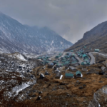
Zuluk
The journey became more thrilling as we approached Zuluk, known for its famous hairpin bends. Situated at 10000 feet, Zuluk is a small settlement with a significant army presence. The area offers stunning mountain views, with spring bringing vibrant rhododendron blooms. Zuluk is often shrouded in mist and clouds, adding to its charm. During winter, the region experiences heavy snowfall.
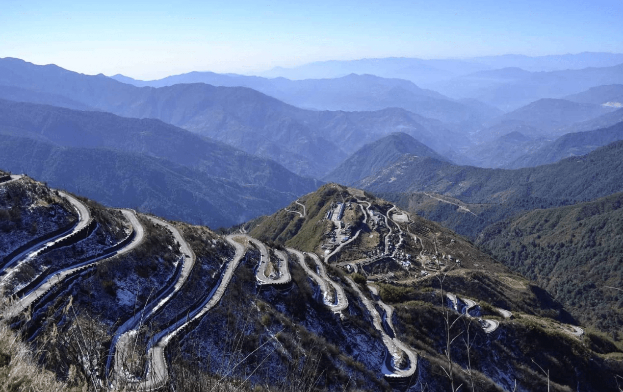
Day 3: Zuluk to Nathang Valley (24 km)
This day involved driving through the renowned zig-zag roads of the Silk Route and visiting Thambi Viewpoint, known for its sunrise views. However, due to the cloudy weather, we missed the sunrise and did not rise early.
Thambi Viewpoint
Located 14 km from Zuluk at 11600 feet, Thambi Viewpoint offers breathtaking views of the mountain loops and sunrise. The viewpoint is also home to Lungthung Viewpoint, 2 km away, providing panoramic views of the Kanchenjunga ranges.
Nathang Valley
At 13500 feet, Nathang Valley, known as the “Ladakh of the East,” features a barren landscape with mountain streams. The valley’s colors change with the seasons: vibrant blooms in spring, golden-yellow hues in autumn, and a snowy blanket in winter. The valley has about 50 Tibetan-origin houses and offers a few homestays. A Buddhist Monastery and Krishna Temple are also worth visiting.
Day 4: Nathang Valley – Kupup Lake – Baba Mandir – Gangtok (74 km)
On our final day, we opted to stay at Nathang Valley and explore nearby attractions before heading to Gangtok. Notable sites include:
Eagle Nest Bunker
Located a few kilometers from Nathang Valley at 13700 feet, this abandoned bunker offers panoramic views of the Eastern Himalayas and Kanchenjunga ranges.
Kupup Lake
Known as Elephant Lake due to its shape, Kupup Lake is a clear blue lake on a clear day.
Memencho Lake
Accessible only by a 4 km trek, Memencho Lake is surrounded by conifers and is a serene spot.
Tukla Valley
Located 15 km from Kupup, Tukla Valley is an unexplored area close to international borders. It features the Yak Course, the highest golf course globally.
Old Baba Mandir
The actual bunker where Baba Harbhajan Singh resided, with the New Baba Mandir located 10 km away. The Silk Route then merges with the conventional road towards Nathula and Gangtok.
Tsomgo Lake
On the way to Gangtok, Tsomgo Lake, a sacred and scenic lake, is a popular attraction.
Tentative Sikkim Silk Route Itinerary
- 2N/3D Itinerary
- Day 1: NJP – Aritar/Mankhim
- Day 2: Aritar/Mankhim – Zuluk
- Day 3: Zuluk – Nathang Valley – Gangtok
- 3N/4D Itinerary
- Day 1: Gangtok – Nathu La – Nathang Valley
- Day 2: Nathang Valley – Zuluk – Padamchen
- Day 3: Padamchen – Mankhim
- Day 4: Mankhim – NJP
- **
5N/6D Itinerary**
- Day 1: NJP – Aritar
- Day 2: Aritar – Zuluk
- Day 3: Zuluk – Nathang Valley
- Day 4: Nathang Valley – Kupup Lake – Baba Mandir – Gangtok
- Day 5: Gangtok – Tsomgo Lake – Nathu La
- Day 6: Gangtok – NJP
Permits Required
Permits for the Sikkim Silk Route can be obtained from the Tourism Office at Gangtok or at the Rangpo Checkpost. An Inner Line Permit (ILP) is mandatory for visiting areas beyond Rongli. Necessary documents include:
- Two passport-sized photographs
- A photo ID (Aadhaar card, driving license, etc.)
- A permit fee of ₹100 per person
Sikkim Silk Route Travel Tips
- Weather: The best time to visit is from March to June and September to November. The weather in winter is extremely cold, and snowfall is common.
- Clothing: Carry warm clothing, especially if traveling in winter. A light raincoat is useful during the monsoon season.
- Altitude Sickness: Be cautious of altitude sickness as you ascend. Acclimatization is crucial for a comfortable trip.
Final Thoughts
The Sikkim Silk Route is a hidden gem offering a unique blend of history, culture, and breathtaking natural beauty. From the winding roads of Zuluk to the serene landscapes of Nathang Valley, this journey provides a glimpse into a fascinating past while showcasing the diverse landscapes of Sikkim.